Advanced technology
ASPECT consists of a suite of sensors and software mounted in an aircraft that, within a single pass of the aircraft, can generate data in a variety of formats to produce scientifically valid products within five minutes of data collection. Primary sensors and features include:
- Infrared Line Scanner
- High Speed Infrared Spectrometer
- Gamma-Ray Spectrometers
- Digital Aerial Cameras
- Satellite Data System
- Data Delivery Using Google Earth Display Tool
DEPLOYMENTS
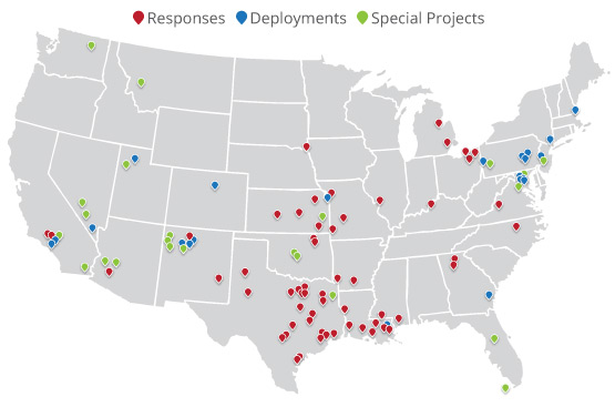
We've been deployed across the country more than 140 times since 2001 to support local, national, and international agencies with hazardous substance response and radiological incidents.
- 58 Emergency Responses
- 21 SEAR Deployments
- 12 NSSE Deployments
- 9 FEMA Activations
- 28 Special Projects
Airborne ASPECT AND THE EPA

Airborne ASPECT provides services through the Environmental Protection Agency's Chemical, Biological, Radiological, and Nuclear Consequence Management Advisory Division (CMAD), which provides 24/7 scientific and technical expertise for all phases of consequence management. Learn more about our relationship with the EPA.
critically important
- Nation’s only 24/7 airborne chemical, radiological, and situational awareness remote sensing aircraft
- Provides information to first responders that is timely and useful
- Multi-role responses (homeland security, emergency response, and environmental characterization)
- More than 140 deployments since 2001
Rapid response
- 24/7 readiness level
- Activation with one simple phone call
- Wheels up in under one hour from the time of activation
- Once onsite and data is collected, it takes only about five minutes to process data distribute to first responders
state-of-the-art
- Utilizes five state-of-the-art primary sensors
- Provides infrared & photographic images with geospatial chemical and radiological information
- Information provided to first responders is compatible with numerous software applications


